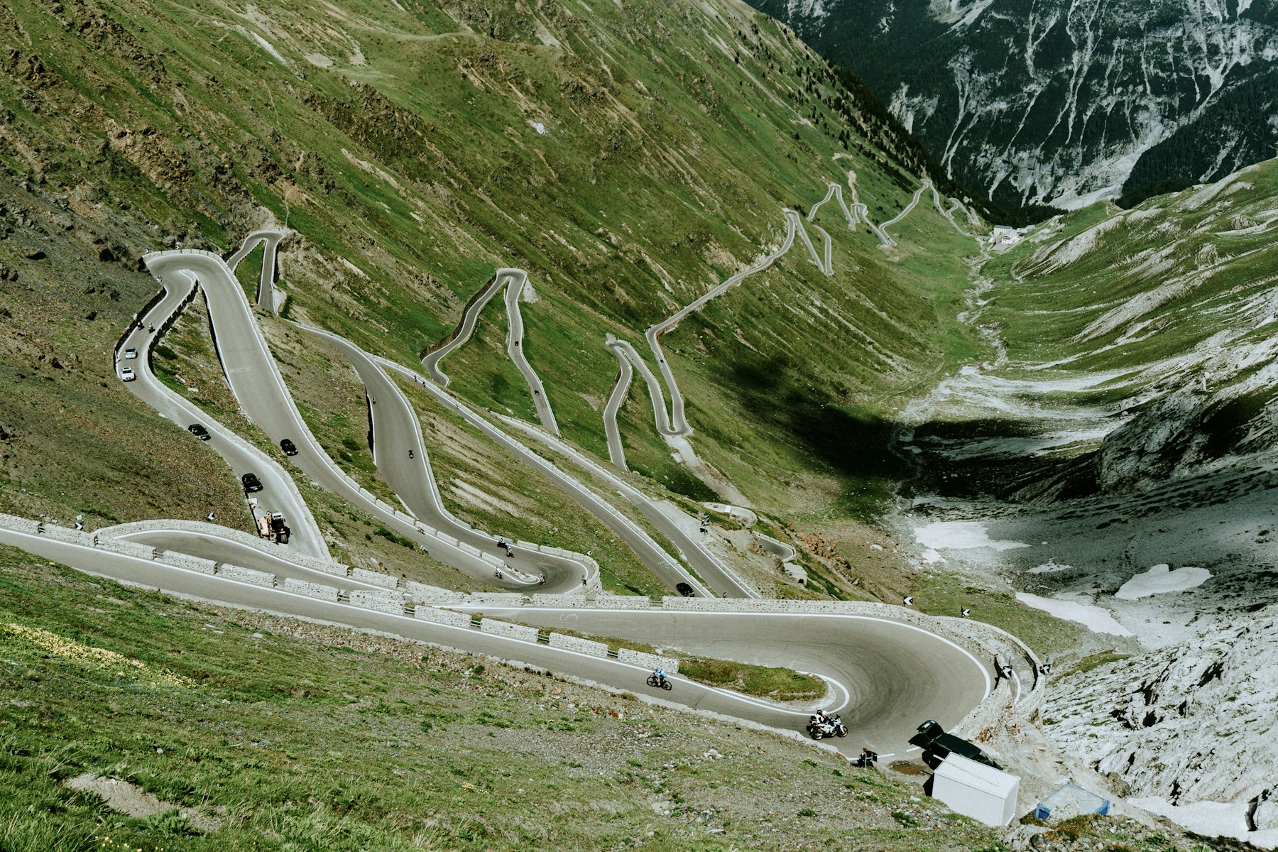
Photo: David Dvořáček / Unsplash
About This Route
This high-Alpine circuit links both main sides of the Stelvio with Switzerland's Umbrail Pass. Starting in Bormio, it crosses into Val Müstair, returns to Italy through Val Venosta and finishes over the 48 numbered bends above Trafoi before descending back to Bormio.
Route plan
- Bormio to Umbrail junctionClimb the SS38 from Bormio through the first series of broad hairpins. At the IV Cantoniera, turn toward Passo Umbrail rather than continuing directly to the Stelvio summit.
- Umbrail Pass to Santa MariaCross into Switzerland at 2,501 metres and descend through the open upper valley to Santa Maria Val Müstair. Carry a passport or national identity card and expect a sharp temperature change at altitude.
- Val Müstair to Prato allo StelvioFollow the valley through Müstair, re-enter Italy and continue via Glorenza to Prato. This is the calmest part of the loop and the best opportunity to refuel before the main climb.
- Prato to Stelvio and BormioThe classic eastern ascent gains roughly 1,800 metres over about 25 km and finishes with 48 numbered hairpins above Trafoi. From the 2,758-metre summit, descend the western ramp back to Bormio.
What the road is really like
The eastern Stelvio ramp is visually spectacular but rarely flowing. Many bends are first-gear turns with steep gradients, cyclists and vehicles using more than their lane. The western Bormio side has longer sight lines, tunnels and a more varied rhythm, while Umbrail feels quieter and more open.
Altitude is the defining difficulty. A warm valley start can become cold rain, fog or sleet near the summit, and snow can close either pass outside the short summer window. The route is paved, but winter damage, repair gravel and damp tunnel exits make a cautious touring pace more appropriate than the Advanced label might suggest.
Planning the day
The official Bormio itinerary measures about 99 km. Allow at least four hours on a motorcycle and considerably longer if you stop at the summit, Glorenza or Val Müstair. Fuel in Bormio or Prato; do not plan around a summit pump.
Both passes are seasonal and event closures can block through travel. In 2026 the Stelvio cycling day closes the road to motor traffic on its published date. Check the South Tyrol road report and the current event calendar on the morning you ride.
Fuel, food and stops
Reliable fuel options along or near the route include Bormio, Prato. Top up before any long climb — pumps in mountain villages can be closed at lunch or on Sundays.
For food and coffee, Summit restaurants are solid stops. Aim for a proper sit-down lunch rather than a vending-machine snack — the locals eat well in this region.
⚠️ Safety and hazards to watch for
Specific hazards on this route include: Altitude; Tour buses; Cyclists.
- Extreme altitude
- Rapid weather changes
- Many cyclists
- Stelvio and Umbrail have annual snow-dependent open/close dates and occasional car-free days — check current conditions before riding.
Who this route suits
Stelvio Pass & Umbrail Combo works especially well for photographers and slow-tour riders chasing scenery, sport-tourers who live for corner-to-corner flow, experienced riders confident on technical terrain, adventure bike riders who don't mind the occasional rough patch. Recommended bike types are Touring, Adventure, but realistically anything in good mechanical condition with decent tyres will do the job — the road matters more than the badge on the tank.
Insider tips
- Start early to beat traffic
- Check road opening dates
- Fuel up in Bormio