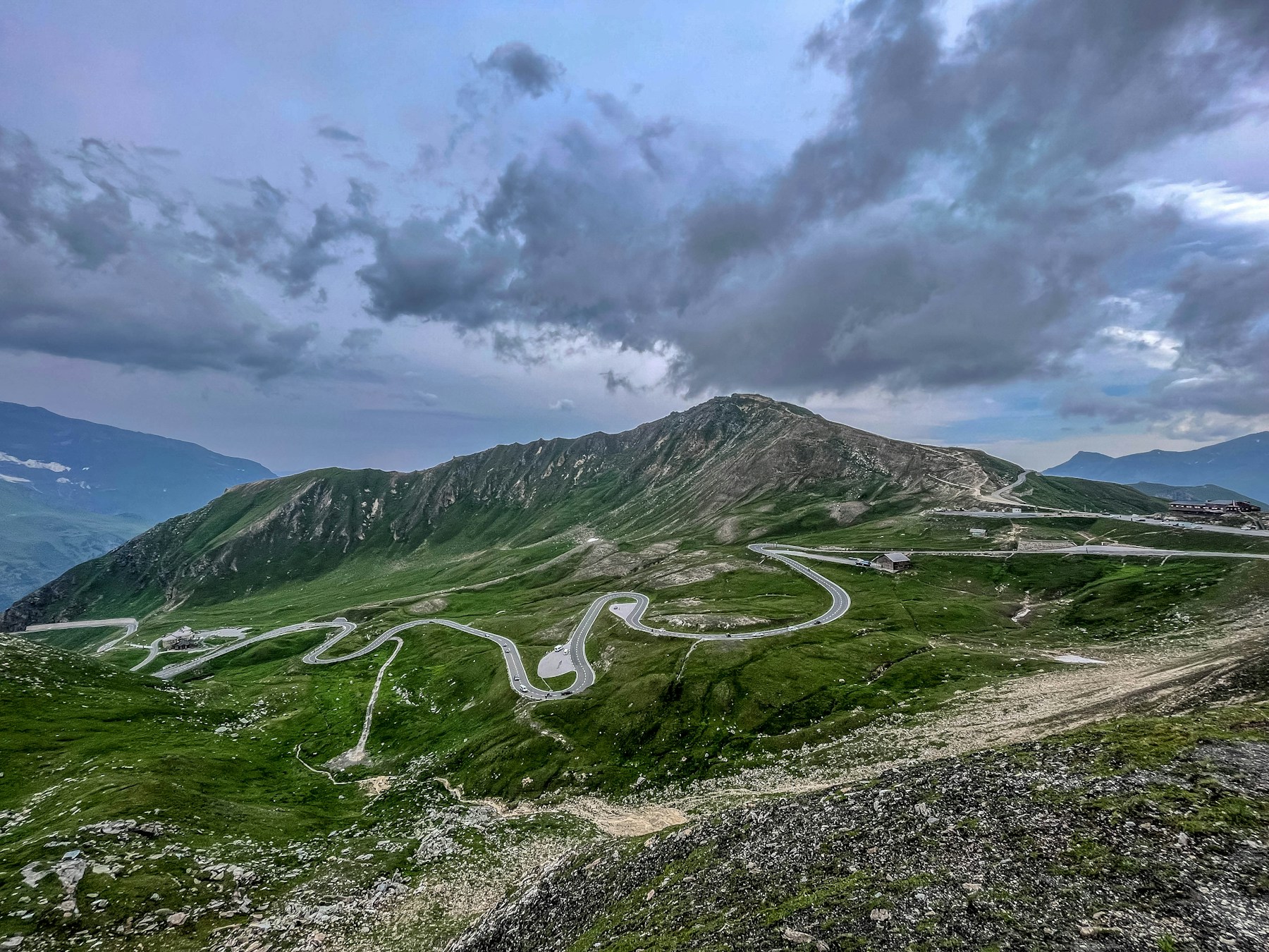
Austria’s most useful motorcycle roads fall into two groups: seasonal scenic toll roads built around the journey itself, and ordinary mountain connections that link the valleys between them. The famous names are not interchangeable. Grossglockner is a major high-Alpine day, Nockalmstraße is lower and more flowing, and Gerlos combines a year-round corridor with access to the Krimml waterfalls.
This guide focuses on those three roads because their operators publish current access information. Silvretta High Alpine Road is deliberately not presented as a current riding recommendation: the operator states that rockfall and mudslide risk will keep it closed through the 2026 season.
1. Grossglockner High Alpine Road
The Grossglockner High Alpine Road runs for 48 km between the northern approach at Fusch/Ferleiten and the southern side toward Heiligenblut. The operator lists 36 bends on the core road. Hochtor is on the through route, while Edelweissspitze and Kaiser-Franz-Josefs-Höhe are separate spurs that add time and should not be treated as automatic waypoints.
Edelweissspitze reaches the road’s highest point at 2,571 metres and uses a narrower, steeper approach than the main road. Kaiser-Franz-Josefs-Höhe is the longer glacier-view detour. A rider who wants both viewpoints should allow at least half a day and enter well before the final admission time.
Plan this road correctly
- Check the operator’s live status, daily gate hours and weather notice on the riding day.
- Refuel before the gate and do not assume every facility stays open as long as the road.
- Use signed motorcycle parking and stopping areas rather than exposed verges.
- Skip the Edelweissspitze spur in cloud, heavy traffic or if steep first-gear hairpins are uncomfortable.
2. Nockalmstraße
Nockalmstraße covers 34 km between Innerkrems and Ebene Reichenau through the Nockberge Biosphere Reserve. The rounded mountains and longer-radius bends make it a less intense ride than Grossglockner, but that does not make it an unrestricted public road. It is a seasonal toll road with operating rules set by the road company.
The official 2026 information states that the road normally operates from early May to late October. Motorcycles are prohibited between 18:00 and 08:00, with final motorcycle entry at 17:15. That detail matters more than an old opening-hours screenshot: arriving near evening can leave the entire planned crossing unavailable.
Allow around two hours if you intend to stop at viewpoints or exhibitions. The operator estimates about 45 minutes for a direct crossing, but using that as the whole schedule removes any buffer for queues, weather or photographs.
3. Gerlos Alpine Road and Krimml
The full connection between Zell am Ziller and Mittersill is about 69 km. The core Gerlos Alpine Road is a 12 km panoramic toll section climbing from the Krimml side toward the pass. Unlike the two roads above, its operator describes it as open year-round, although works and weather can still cause delays.
Gerlos works best as part of a transfer between Tyrol and Salzburg rather than as a short out-and-back. A stop for the Krimml waterfalls requires walking time, parking and a separate decision about visitor access. Do not include the falls in a tight two-hour riding estimate simply because they appear beside the road on the map.
Check the operator’s live vehicle status before departure. “Open year-round” describes the general operating model, not a guarantee that construction, forestry work or severe weather cannot affect a particular day.
A realistic five-day Austrian plan
- Day 1 — Arrive near Zell am See or BruckUse the arrival day for fuel, tyre and weather checks instead of adding a late mountain-road crossing.
- Day 2 — GrossglocknerEnter from the Fusch side, add viewpoints only in stable weather and stay near Heiligenblut or return according to the next day’s direction.
- Day 3 — Lower-altitude transferKeep a flexible valley day after Grossglockner. This is the weather reserve if the high road was unavailable on Day 2.
- Day 4 — NockalmstraßeEnter early enough to respect the motorcycle closing time, then continue toward Carinthia or a base for the return journey.
- Day 5 — Gerlos or departureUse Gerlos when it aligns with a westbound transfer; otherwise keep the day for a direct route home rather than forcing another toll road.
This plan is intentionally not a loop containing every Austrian pass. The three roads are spread across different regions, and transfer days remain real travel days even when the motorway makes the distance look easy.
Vignettes and separate scenic-road tolls
Motorcycles need an Austrian vignette to use motorways and expressways unless a specific exception applies. In 2026, one-day, ten-day, two-month and annual motorcycle products are available. An online digital annual or two-month vignette bought by a consumer may not become valid until the eighteenth day because of withdrawal rules; short products and purchases at physical sales points can have different activation arrangements.
The motorway vignette does not pay for Grossglockner, Nockalmstraße or the toll section of Gerlos. Those roads issue their own tickets. Conversely, riders staying entirely on ordinary roads and scenic toll roads should not buy a motorway vignette automatically without first checking the actual route.
Season and road-choice cautions
- High-road season: Grossglockner and Nockalmstraße publish seasonal operation, but daily weather can still override the calendar.
- Silvretta: do not build a 2026 itinerary around the through road; the operator says it will remain closed because of geological risk.
- Motorcycle hours: Nockalmstraße’s motorcycle curfew is stricter than its general daytime attraction hours.
- Temperature: a warm valley does not predict conditions at Hochtor or Edelweissspitze.
- Traffic: coaches, cyclists and vehicles turning into viewpoints interrupt otherwise predictable bends.
- Navigation: inspect motorway connectors before choosing “avoid tolls”; the setting may also remove a road you intended to ride.
Continue planning
Compare Austria with the four-country Alps guide, the detailed Grossglockner route and the wider Europe planning guide.