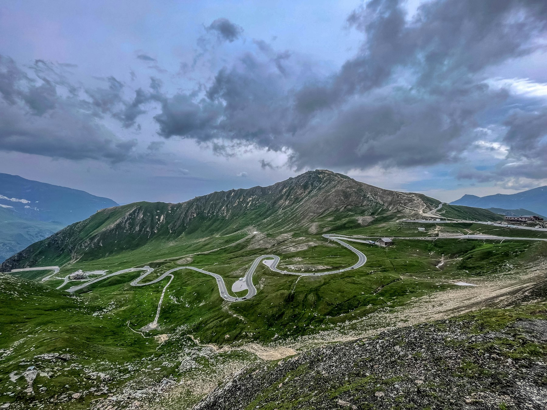
Photo: Tim D / Unsplash
About This Route
The 48 km Grossglockner High Alpine Road links Bruck/Fusch with Heiligenblut through Hohe Tauern National Park. Its main line crosses Hochtor, while separate spurs reach Edelweissspitze and Kaiser-Franz-Josefs-Höhe below Austria's 3,798-metre Grossglockner.
Route plan
- Bruck and Fusch to FerleitenFollow the signed kilometre markers from Bruck and approach the northern toll gate at Ferleiten. Refuel before the gate and check the day's closing time rather than assuming access lasts until sunset.
- Ferleiten to Fuscher TörlThe road climbs through repeated engineered bends toward the main ridge. Use the signed motorcycle stopping areas and be alert for traffic turning into viewpoints.
- Edelweissspitze optional spurThe short panoramic spur climbs above the main road and is narrower and more technical than the core route. Skip it in cloud, heavy traffic or if low-speed hairpins on steeper gradients are uncomfortable.
- Hochtor to Kaiser-Franz-Josefs-Höhe or HeiligenblutCross the 2,504-metre Hochtor tunnel area, then choose the glacier-view spur to Kaiser-Franz-Josefs-Höhe before returning to the main road and descending toward Heiligenblut.
What the road is really like
Unlike an ordinary public pass, Grossglockner is a managed scenic toll road with maintained viewpoints, exhibitions and motorcycle facilities. The asphalt and corner geometry are consistent, but that accessibility attracts coaches, cars and riders of very mixed experience.
The official road reaches 2,571 metres on the Edelweissspitze spur; Hochtor on the through route is lower. Cold, wind and cloud can arrive quickly above the tree line. Marmots and other wildlife near stopping areas are another reason to keep speed conservative.
Planning the day
The 48 km figure describes the official road, not a round trip or every spur. Allow at least half a day for viewpoints; a return ride and both major spurs take longer. The ticket, opening hours and repeat-entry terms change by season, so verify them directly with the operator.
The road closes overnight and for winter, and the gates may close temporarily in poor weather. Check the live status before leaving Bruck or Heiligenblut. The toll is for this scenic road and is separate from Austria's motorway-vignette rules.
Fuel, food and stops
Reliable fuel options along or near the route include Bruck, Heiligenblut. Top up before any long climb — pumps in mountain villages can be closed at lunch or on Sundays.
For food and coffee, Summit restaurants are solid stops. Aim for a proper sit-down lunch rather than a vending-machine snack — the locals eat well in this region.
⚠️ Safety and hazards to watch for
Specific hazards on this route include: Altitude; Cold at summit; Tourists.
- Toll road
- Variable weather
- Toll road with annual open/close dates and daily gate hours (closed at night); toll prices change yearly — check current conditions and prices before riding.
Who this route suits
Grossglockner High Alpine Road works especially well for photographers and slow-tour riders chasing scenery, adventure bike riders who don't mind the occasional rough patch. Recommended bike types are Touring, Adventure, but realistically anything in good mechanical condition with decent tyres will do the job — the road matters more than the badge on the tank.
Insider tips
- Visit Kaiser-Franz-Josefs-Höhe
- Toll required
- Multiple viewpoints